
File Photo
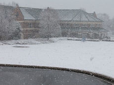
The Thornblade Club in Greer, home course of the BMW Pro-Am, is always picturesque. A heavy snow forecast overnight should lend to more postcard-type photos.
File Photo
On the home page: The Benson Campus of Greenville Technical College in Greer.
A low pressure system over the Northwest Gulf of Mexico this evening, and then track quickly northeastward along the Carolina coast tonight. At the same time, colder air is expected to move down from the north. Precipitation will begin as rain in some areas outside the mountains, but is expected to change over to snow as the Intensity increases and the temperature cools into the evening hours. The snow is likely to become heavy at times during the evening hours as the low pressure system makes its closest pass by the area.
The heavy snow will move east and taper off early Thursday morning as the low moves northeast across the western Atlantic.
Winter Storm Warning remains in effect until 7 am EST Thursday.
- Locations: for most of western North Carolina, Northeast Georgia and the South Carolina Upstate.
- Hazards: rapidly accumulating snow on highways this evening into early Thursday that will cause very hazardous travel conditions. Heavy snow will restrict visibilities to less than a half a mile at times.
- Timing: precipitation will arrive in Northeast Georgia, the Western upstate of South Carolina and the Southwest Mountains of North Carolina by late this afternoon and then quickly spread east across the remainder of the area early this evening. Rain may occur initially but quickly transition to snow.
- Accumulations: snow accumulation of 5 to 8 inches across the foothills and northern upstate of South Carolina. Areas along and east of the Interstate 77 corridor across Charlotte metro area may see values between 10 to 12 inches.
- Impacts: hazardous travel conditions due to snow on highways.
- Temperatures: falling into the lower 30s.
- Winds: East 5 to 10 mph.
Recommended actions
A Winter Storm Warning for heavy snow means severe winter weather conditions are expected. Significant amounts of snow are forecast that will make travel dangerous. Only Travel in an emergency. If you must travel, keep an extra flashlight. Food, and water in your vehicle in case of an emergency.
Stay tuned to NOAA weather radio or your favorite source of weather information for the latest updates. Additional details can be found at www.weather.gov/gsp.